S3E1 Mary Morrissey’s Comparison of Rhode Island’s and Maine’s Offshore Wind Development
This episode explores how Maine can use Rhode Island as a model to guide offshore wind development in federal waters. This episode is based on an article by Mary Morrissey, “Maine and Offshore Wind Development: Using the Coastal Zone Management Act and Marine Spatial Planning to Influence Projects in Federal Waters,” published in Volume 31, Number 1, of Maine Policy Review, a peer-reviewed academic journal published by the Margaret Chase Smith Policy Center.
[00:00:00] Eric Miller: How can looking to Rhode Island as an example in offshore wind development benefit Maine? Today we will be looking at a comparison drawn between Rhode Island and Maine’s offshore wind development projects made by Mary Morrissey, a law student and editor-in-chief of the Ocean and Coastal Law Journal at the University of Maine School of Law.
[00:00:24] Eric Miller: Welcome back to Maine Policy Matters. A podcast from the Margaret Chase Smith Policy Center at the University of Maine. I am Eric Miller, research associate at the center. On each episode of Maine Policy Matters, we discuss public policy issues relevant to the state of Maine. On our first episode of season three, we will be covering an article by Mary Morrissey, who gives us an inside perspective on Maine’s offshore wind development and proposes short- and long-term actions to guide Maine’s development of the offshore wind industry in federal waters in her article, “Maine and Offshore Wind Development: using the Coastal Zone Management Act and Marine Spatial Planning to Influence Projects in Federal Waters.” This article was published in Volume 31, number 1 of Maine Policy Review, a peer-reviewed academic journal published by the Margaret Chase Smith Policy Center. For all citations for data provided in this episode, please refer to Morrissey’s article in Maine Policy Review.
[00:01:18] Eric Miller: How can comparing Rhode Island’s Coastal Management Plan help Maine’s current offshore wind efforts and potential for marine spatial planning? Morrissey provides some recommendations based on the Governor’s Energy Office offshore wind roadmap process.
[00:01:31] Eric Miller: Morrissey outlines the actions that Maine can take to replicate Rhode Island’s model in a ‘responsible’ way – as concerns for sustainability of marine ecosystems and the coastal economy are quite high, given the environmental challenges on the horizon. Back in 1972, Congress passed the Coastal Zone Management Act, or the CMZA, to “preserve, protect, develop, and where possible, to restore or enhance the resources of the nation’s coastal zone.” This act encourages states develop and implement their own management programs for land and water resources of their spatial zone. For example, both Rhode Island and Maine participate in the CMZA and have their own coastal management plans. Where Maine can learn from Rhode Island is their Site Assessment Management Plan, referred to as an S-A-M-P. Maine has yet to designate a SAMP.
[00:02:25] Eric Miller: Morrissey cites that, “Marine spatial planning is a public sociopolitical process that aims to manage human activities to achieve predetermined outcomes.” Marine spatial planning is important because it identifies areas of ecological concern, makes space for conservation efforts, and protects cultural heritage among many other benefits. Even though there are many benefits to marine spatial planning, Morrissey names five main challenges. The first is marine spatial planning cannot effectively be carried out without legislative and regulatory efforts. Second, the necessity of stakeholder engagement to produce an innovative, long-term plan. Third, the requirement for collaboration and coordination to allow for engagement with administrative entities and overlap with regional, local, and other strategic plans, policies, and laws. Fourth is managing errors and plan design and execution. And lastly, that marine spatial planning is a process that can slow offshore wind development.
[00:03:26] Eric Miller: As an example of a state that successfully faced these challenges, Morrissey discusses Rhode Island’s offshore wind planning, and their Ocean SAMP. This regulatory document was the result of 2006 Governor Donald Carcieri’s goal of harnessing 15 percent of the state’s electricity from wind within a span of three years, as Morrissey explains:
[00:03:48] Eric Miller: “The Ocean SAMP is a regulatory document made up of three integrated approaches: research, policymaking, and public engagement. It maps a portion of Rhode Island’s state and surrounding federal waters to identify how to use this region and manage its resources to support the state’s environmental, social, and economic needs. It also specifically details potential effects on existing uses and resources in the Ocean SAMP area, including impacts on port development and job creation, electricity rates, coastal processes and physical oceanography, marine mammals, and commercial and recreational fishing. Ultimately the Ocean SAMP was one of the first marine spatial plants in the nation, and ‘laid the groundwork for the sighting and permitting of the nation’s first offshore wind farm.'”
[00:04:36] Eric Miller: It was not until 2010 that the Coastal Resources Management Council approved the Ocean SAMP, giving it the force of the law. In 2011, NOAA approved the Ocean SAMP as part of Rhode Island’s coastal management plan, which meant that federal actions that have reasonably foreseeable effects on Rhode Island’s Coastal Zone must undergo federal consistency review to ensure that they do not conflict with Ocean SAMP. This created an issue because NOAA only insured federal action that impacted the state waters were consistent with Rhode Island’s Coastal Management Plan. This led Rhode Island to take a new approach to apply for a geographic location description.
[00:05:20] Eric Miller: This request was approved in late 2011, and the executive Director of the Coastal Resource Management Council, Grover Fugate, remarked that the geographic location was “the first of its kind in the state and in the nation, and allows the Coastal Resource Management Council to have a voice in what kind of offshore development takes place in the federal waters off Rhode Island’s coast. This tool will work as a major component of the Ocean SAMP, and both will further Rhode Island’s role as a model for other states in marine spatial planning.
[00:05:52] Eric Miller: Ocean SAMP has five other strengths and strategies that Maine could find useful: conceptual benefits, tangible goals and guiding principles, strong university engagement and research, extensive stakeholder and public engagement, and adequate funding.
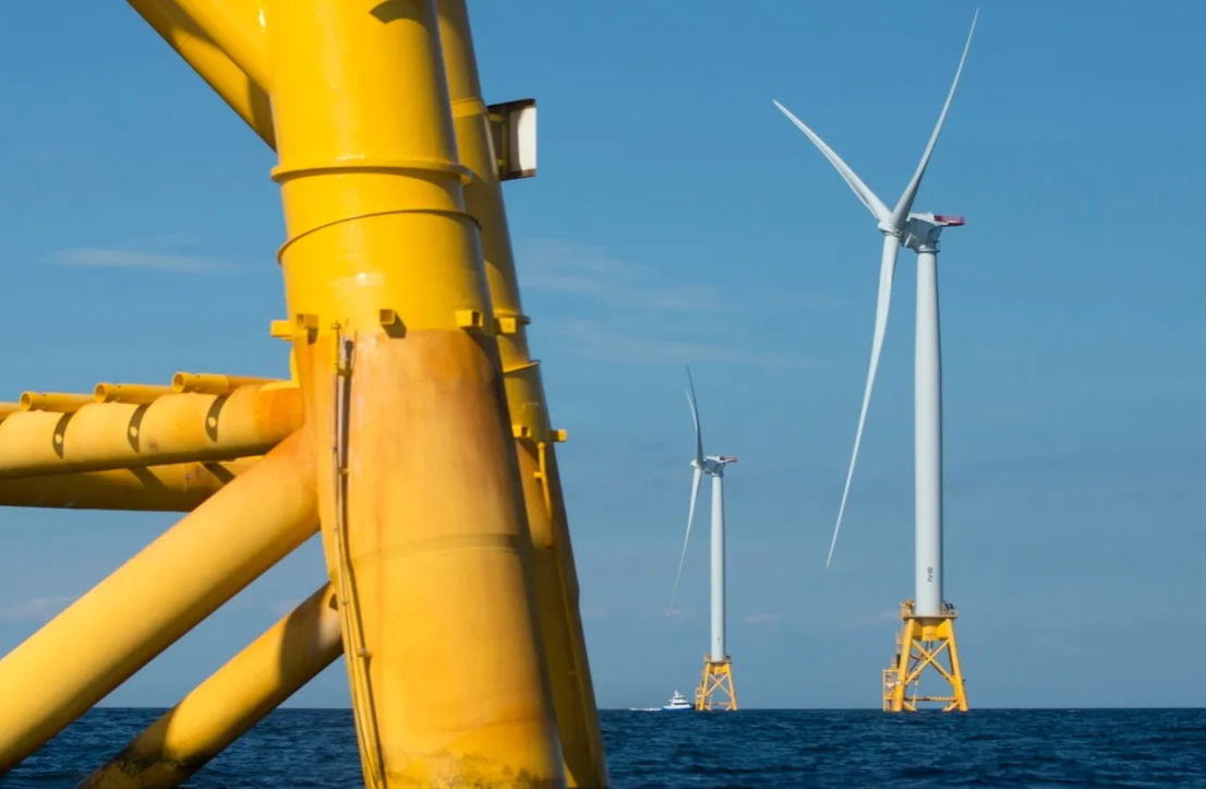
[00:06:08] Eric Miller: In 2019, Governor Mills received a request from the board of Ocean Energy Management to join a Gulf of Maine Intergovernmental Renewable Energy Task Force. In response, Maine began focusing on its offshore wind through four efforts. The first is Aqua Ventis, an 11-megawatt floating offshore wind technology pilot. It will be located south of Monhegan Island, more than 12 miles off the coast of Maine. The University of Maine designed the VolturnUS floating concrete hull technology that will support the wind turbine and will lead design, engineering, research and development and post-construction monitoring. UMaine and the US Department of Energy also funded many studies and surveys to help these efforts.
[00:06:51] Eric Miller: The second effort is what is being called a research array, the nation’s first floating offshore wind research site in federal waters, which is a response to the federal government’s ambitious energy goals, and to “ensure that Maine develops [the offshore wind] industry in a manner that capitalizes on [its] innovative technology and abundant resources, while protecting [its] interests, industries, environment, and values.”
[00:07:16] Eric Miller: The third is a roadmap supported by a $2.166 million grant from the US Economic Development Administration, that will detail how to advance offshore wind in ways that support Maine’s people, economy, and heritage. The roadmap also looks to understand and plan for the state’s role in commercial offshore wind in the Gulf of Maine.
[00:07:36] Eric Miller: The fourth is a moratorium on offshore wind projects that was established by Governor Mills to restrict the state from licensing, permitting, approving, or authorizing leases, easements, or other real property interests for offshore wind projects in state waters for 10 years. The Mills Administration also proposed the moratorium to appease fishing interests, especially lobstermen, who opposed the research array over concerns about what they saw as potentially disastrous impacts on the lobster industry.
[00:08:06] Eric Miller: Morrissey suggests that “if Maine can implement a marine spatial plan, there are potential environmental, social, and economic benefits- not least of which would be more efficient coordination of offshore wind efforts with other marine industries such as aquaculture and fisheries, while protecting areas of biological and ecological concern.”
[00:08:26] Eric Miller: However, she names a few challenges and possible solutions for implementing this planning. The first is the risk of interrupting progress from changes in administration, as well as fitting Maine’s legislative and regulatory process. Planning for differences in administration stance toward marine spatial planning policy is not something that can necessarily be codified with ease, to say the least. However, regarding the issue of fitting a SAMP to Maine’s legislative and regulatory framework, Maine could follow Rhode Island’s plan of building a regulatory framework explaining the marine spatial plan’s goals, means of implementation, decision making authority, general policies and regulatory standards.
[00:09:07] Eric Miller: The second challenge is Maine’s large gulf size. The Gulf of Maine spans 36,000 square miles of ocean and 7,500 miles of coastline, with Maine stretching along 3,478 miles of that coastline, and the rest being split between Nova Scotia, New Brunswick, New Hampshire, and Massachusetts. In comparison, Rhode Island only has 384 miles of coastline with Ocean SAMP, covering roughly 1,467 square miles of the ocean, as well as no international border. Maine would need to expand more energy and resources to define the limits of a marine spatial plan and divide the area among different ocean uses.
[00:09:53] Eric Miller: The third is concerns for collaboration. Maine must obtain support from its fishing communities, particularly lobstermen with over 4,800 lobster licenses, to successfully create a marine spatial plan.
[00:10:06] Eric Miller: As a solution to these concerns, Morrissey closes her article with several actions that Maine can take to replicate Rhode Island’s model and responsibly develop offshore wind in the Gulf of Maine.
[00:10:17] Eric Miller: Regarding actions that could be taken immediately. Morrissey outlines the following: increasing opportunities for public engagement beyond a public comment period, including fishing community and research, facilitate collaboration and investigating research gaps using public tools – such as the Northeast Data Portal, develop educational materials to communicate the benefits of offshore wind development, and developing partnerships with other Northeastern coastal states to identify points of concern and how the Gulf of Maine will be affected.
[00:10:48] Eric Miller: Beyond the immediate actions, Morrissey outlines longer-term options, including signing memorandums of understanding with neighboring coastal states to facilitate collaboration, a marine spatial plan like the Rhode Island SAMP discussed earlier, codifying the marine spatial plan, and then expanding it into federal waters.
[00:11:08] Eric Miller: As a final note on this issue, Morrissey concludes: “Rhode Island serves as a primary example of how to use federal consistency review and marine spatial planning effectively in the form of an Ocean SAMP. Maine can begin working on its own marine spatial plan by capitalizing on preexisting efforts. The offshore wind industry is moving quickly, and it is Maine’s best interest to take proactive steps to extend its influence into federal waters. Maine’s marine economy, environment and ecology depend on it.”
[00:11:45] Eric Miller: What you just heard was Mary Morrissey’s perspective on offshore wind development and marine spatial planning in Maine, based on her article in Maine Policy Review, a peer reviewed academic journal published by the Margaret Chase Smith Policy Center. The editorial team for Maine Policy Review is made up of Joyce Rumery, Linda Silka, and Barbara Harrity. Jonathan Rubin directs the Policy Center. A thank you to Jayson Heim and Kathryn Swacha, script writers for Maine Policy Matters, and to Daniel Soucier, our production consultant.
[00:12:12] Eric Miller: In two weeks, we’ll be hosting professionals in the lobster industry for an interview and a synopsis of James and Anne Acheson’s article titled, “What Does the Future Hold for Maine’s Lobster Industry?”
[00:12:23] Eric Miller: We’d like to thank you for listening to Maine Policy Matters from the Margaret Chase Smith Policy Center at the University of Maine. You can find us online by searching Maine Policy Matters on your web browser. If you enjoyed this episode, please follow us on your preferred social media platform to stay updated on new episode releases.
[00:12:39] Eric Miller: I’m Eric Miller. Thanks for listening, and please join us next time on Maine Policy Matters.